Maps

MSCH

Well-known member
in this world of GPS and Google Earth, how many of you still use paper maps?

reason I said this is somebody had never heard of STAA approved roads
I have a Truckers Atlas
that labels all the STAA roads in the USA .
It also has a glossary of every low clearance point on truck roads in the USA and Canada.

I have a Garmin Truckers GPS, which is great
but I go with maps first, then use the GPS...
 
We still keep an atlas in the truck and my better half prefers it. We even have a truckers atlas, I just hadn't heard the term STAA. I prefer to use a map for all of our trip planning, because it's much easier to get the big picture. Google maps for local areas blown up is better than a paper atlas.
 
We still keep an atlas in the truck and my better half prefers it. We even have a truckers atlas, I just hadn't heard the term STAA. I prefer to use a map for all of our trip planning, because it's much easier to get the big picture. Google maps for local areas blown up is better than a paper atlas.
exactly. I've used Google maps to find alternate streets thru areas, where a map doesn't have the detail necessary to see them.
 
All digital here. I'll admit that would be a disadvantage in a non-cell area, but we currently don't travel in those for the most park.

Now 2025 when we do our SD trip I might grab a few as backup.

I spend hours and hours looking at Google Earth sometimes. I see something in a TV show that is interesting, I'm off to GE to find out where it was filmed or what was around there.

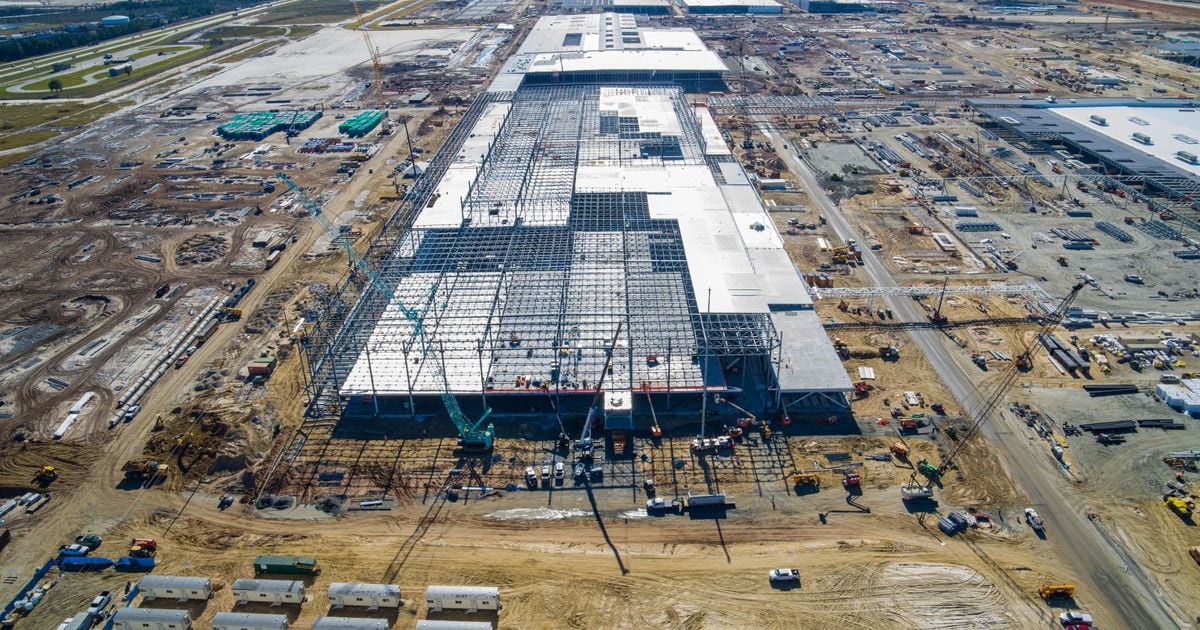
Driving down to Savannah this weekend, there is a massive, and I mean MASSIVE plant being constructed outside Savannah that I hadn't heard about. First thing I did when we got set up was to pop on the internet and find out what it is. It isn't on any of the digital maps just yet, but it is Hyundai's new 'MetaPlant' where they are going to build EV's. It is huge.

 
I still carry AAA maps for every western state plus the "Western States" map. That's what the driver-door map pocket is for...
 
I prefer a map or atlas to plan for a trip and for unplanned detours. Last minute changes about where we are going next and anytime I decide to take a route Im not familiar with. Google and Apple maps are ok for finding a restaurant or local attractions but give me the paper for the big moves.
The last trip we made, I forgot mine and we changed our itinerary mid trip. Will not let it happen again. We finally found a state map for the unfamiliar area we were headed.
 
Apple or google maps for me. I haven’t used a paper map or atlas in years. My wife is a map turner so navigation was always difficult. She once turned the map the wrong way and boy that got interesting in multiple lanes of traffic on a Friday afternoon. 🤣
Good news was we were in a pickup only.

Just my $0.02
 
I started my trucking career in 1980 before cellular phones and GPS. I would get my dispatch and look at it on my atlas and make a mental note where I had to change highways. If I had to find an address in a large city (such as Houston) I would stop at a TS and they had a big map on the wall and a directory to find the coordinates on their map. Like has been said, I use Google or Apple for maneuvering city streets but I still like to know where to make route changes.
 
I started my trucking career in 1980 before cellular phones and GPS. I would get my dispatch and look at it on my atlas and make a mental note where I had to change highways. If I had to find an address in a large city (such as Houston) I would stop at a TS and they had a big map on the wall and a directory to find the coordinates on their map. Like has been said, I use Google or Apple for maneuvering city streets but I still like to know where to make route changes.
me too... I use them maps to give me a big picture idea ahead of time, already know the roads I am looking for and in which town they will be,,, then maybe plug them in as waypoints on the GPS so the GPS doesn't send me the way it thinks is best or fastest or whatever other programming features it has built into it.. the GPS is great for finding your way to the a precise spot in a place otherwise unknown , but it sucks for planning a complete trip, that is where the old standby is best..

I guess I always thought if someone couldn't get from Jacksonville Fl to Atlanta or anywhere else without a GPS, they probably shouldn't be driving.

other thing I dont like about GPS is it doesn't give you cardinal directions, it just shows which way to go... if you are brain dead I guess it is OK to not know North South East and West but that aint for me.
 
We have an atlas and state gazetteers for the states we go to a lot. When we're traveling cross country, like from here to Amarillo I spend time at home on googlemaps satellite view looking at gas stations where a stop should be. Lots of convenience stores aren't set up for trailers, some you plug up travel lanes and make people unhappy. Love's is always the first choice.
 
We have an atlas and state gazetteers for the states we go to a lot. When we're traveling cross country, like from here to Amarillo I spend time at home on googlemaps satellite view looking at gas stations where a stop should be. Lots of convenience stores aren't set up for trailers, some you plug up travel lanes and make people unhappy. Love's is always the first choice.

I do the same. I'll look around on streetview, if available, to verify the store. Hasn't failed me yet.
 
We have an atlas and state gazetteers for the states we go to a lot. When we're traveling cross country, like from here to Amarillo I spend time at home on googlemaps satellite view looking at gas stations where a stop should be. Lots of convenience stores aren't set up for trailers, some you plug up travel lanes and make people unhappy. Love's is always the first choice.

I generally do sort of the same thing... Google Maps is pretty darn nice for that.
 
Top